How to get the Point Cloud Data affordably? It is the first question in mind when you have an object or building for digitization work right? Well, you either need a Mesh, or you need the data to use in your project life-cycle. Acquiring accurate design data from the real world into the digital world can be quite expensive. Whether you are an Architect, or a Professional Engineer or a game developer, Point Cloud Data is conventionally expensive. Numerous software and few ways are using which we can get precise and accurate Point cloud data on an affordable budget.
Let’s see various useful software and tools used for this technology on a budget.
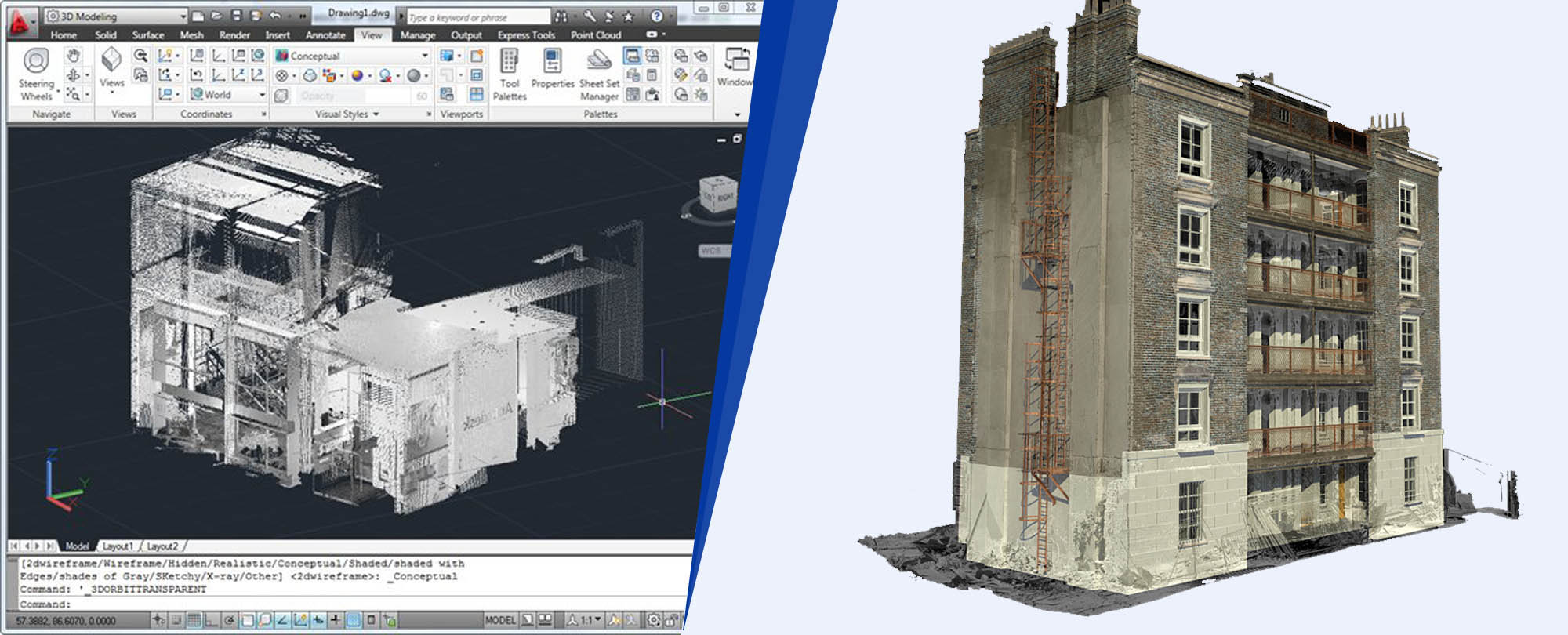
Laser Scanning & Point Cloud
The best way to get the point cloud data is to use professional laser scanning methods like Faro X series scanner. Using the laser scanning methods, the output we get is exceptional. We get very high megapixel images and absolute point accuracy. They are expensive to buy, but they can be rented as well. Yes, this is the best option for the large-scale scanning projects. If you have a small object to get it scanned, then you could use handheld scanners like Faro Freestyle for best accuracy and best quality.
3D Photogrammetry & Point Cloud
What if I tell that you can get this data with your Digital camera or smartphone Camera? Yes, like the photography years ago, 3D scanning has become a lot more affordable for the consumers and small businesses. With the advent of new technologies, the 3D photogrammetry data is more accessible and available to all in the present scenario.
The Autodesk ReCap 360 was launched as a Remake app. It allows us to take a series of photo and generate a point data from the images. And also has the ability to scale this data, so that it can be relatively accurate and precise.
USe of ReCap 360 in Point Cloud
Autodesk ReCap is a smart Reality Capture software. It quickly converts reality into a 3D model or the existing 2D drawings which are further ready for design. The software can integrate any source photos taken from SLR to smartphones and Go Pro camera. It helps to generate high-resolution, detailed 3D models from the source photos. The ReCap software then clubs the photos together. It turns them into a 3D mesh or point cloud creating high-resolution, textured model that can be imported into other Autodesk software. You could even connect or strap your camera to a drone. Process video data into ReCap software as well as generate the point cloud data of larger models.
ReMake for Point Cloud
Well, creating a data with ReCap software is not the final step. It may be an incomplete version or could be only the first step. Users may need to do some post work on the mesh or the point cloud data that has been creating. For this, ReMake is an outstanding application. It gives us the ability to streamline the meshes that the Photogrammetry has created. it also allows the users to fix holes in the mesh, which are the patching holes left by the missing images. ReMake app fixes all the holes. It generates the precise point cloud data. It is one of the best reverse engineering solutions in the construction market.
These technologies are amazing. Furthermore, it furnishes precise and exact point cloud data on an affordable budget. It is highly beneficial for the construction industry professionals.
One Reply to “Ways of Getting Affordable Point Cloud Data”