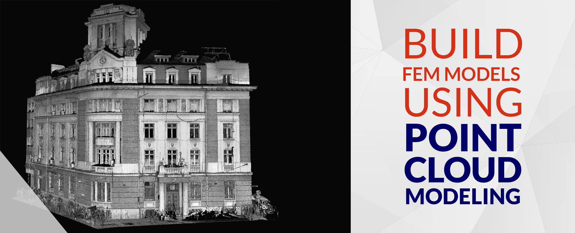
What is Point Cloud Modeling?
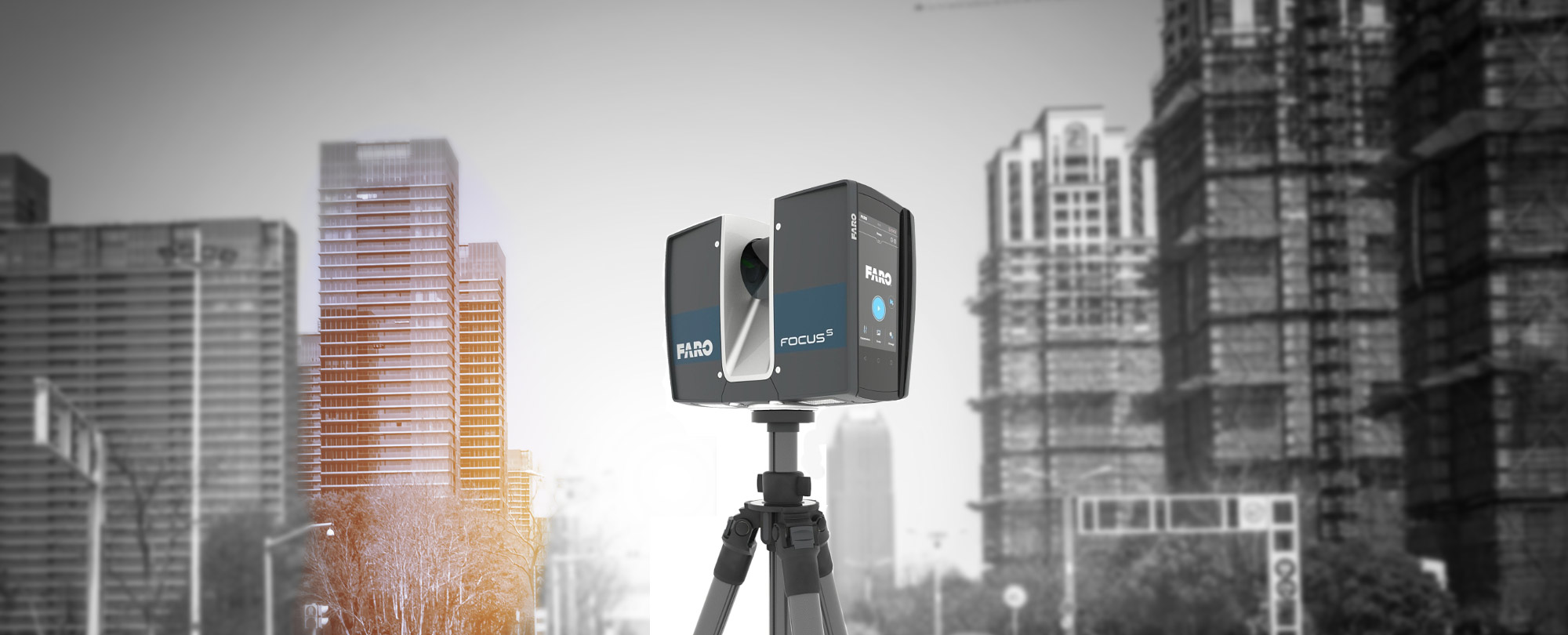
A set of data points in the space forms a point cloud. A 3D laser scanner produces these point clouds. It furthermore calibrates the number of points on the exterior of an object to be modeled. Then the final outcome of the Laser Scanning procedure is point clouds. As a matter of fact, some processes like 3D CAD modeling for fabricated components, MQC (Metrology & Quality Control) analysis, animations, etc., make use of these point clouds. The further procedure after this is point cloud modeling.
The post process of laser scanning consists of a point cloud modeling software that renders the point clouds in the form of a 3D model. This conversion or rendering of point clouds to a 3D model is correspondingly known as surface reconstruction.
Applicability of Point Cloud Modeling
The uses of point cloud modeling are as below:
- Photogrammetry
- Mobile mapping
- Geologic interpretation
- LiDAR (Light Detection & Ranging)
- Predictive modeling
- Forensic analysis
- Reverse engineering
Point Cloud Modeling. How it’s done?
Point cloud modeling is nothing but a ‘Scan to BIM’ procedure.
Point cloud modeling contains of a collection of 1,000,000 data points representing the three-dimensional coordinates of the exterior of a building or any other object. A 3D laser scanner then gathers or captures this data set known as point cloud.
With the help of surface reconstruction strategies and point cloud process computer code tools, the scanned data is furthermore reconstructed into an operating 3D BIM model that reflects the present condition of the building or structure.
Benefits of Point Cloud Modeling
- A quick survey methodology
- Precise 3D model creation
- Reliable and assured modeling quality
- Reduced site revisions
- Reduced RFIs and work stalling
- Detailed understanding of design models
- Effective decision making
- Cheaper project turn-around
Point Cloud Modeling Software
Not to mention, any process is incomplete without the use of a specific equipment or a system. Point cloud modeling hence makes use of software mentioned below:
1. Regard 3D
Regard 3D makes use of a series of photographs of an object for creating its 3D model. Different viewpoint help to capture these photographs.
2. 3DF Zephyr
3DF Zephyr is a software for commercial photogrammetry as well as 3D modeling, developed by an Italian organization; 3DFLOW.
3. Bentley ContextCapture
With ContextCapture, you can produce the most important and complex 3D models of existing real-world conditions, as well as scales as massive as entire cities, from straightforward images.
4. Reality Capture
Reality Capture is a photogrammetry software for creating 3D models from an diverse photographs taken from a camera or a 3D laser scanner of any object.
5. LiMapper
Green Valley International developed LiMapper for utilization in image processing and hence for photogrammetric surveys. The software has an ability to handle large data sets and moreover is a unique set of solutions for photogrammetrists.
The above mentioned point cloud modeling software are Windows, Mac OS, as well as Linux compatible. The users of these software can not only can offer a context for design, construction, but also have multiple operational choices for every type of infrastructure projects throughout the globe.
Discover more: Futuristic Construction Surveying with Point Clouds to BIM
Final thoughts
On present day, the employment of point cloud services is quickly enhancing across the construction industry. Its implementation leads to getting as-built drawing of any residential building, historical infrastructure or building renovation. Lasers moreover facilitate tracing the flaws within a building. Thus, it helps in saving time and price spent on a general project. Therefore, 3D laser scanning and point cloud modeling are now becoming the support systems of BIM services.