Laser scanned data can be extremely valuable for scanning large areas quickly, and more effectively than before. It provides accurate data that can be integrated to Revit models. A three-dimensional approach to BIM with Point Cloud Capturing delivers 3D building elements for other infrastructure like ducts, pipes, and other infrastructure. Recent technological integrations through hardware and software can augment BIM applications in the A/E/C building environment. There is great emphasis on rapid 3D capturing and modeling with 3D laser scanning for virtual design and construction. There’s a pressing need for smart feature detection algorithms and virtual cloud point processing for efficient design, construction and management.
Point Cloud Technology for a Beginner
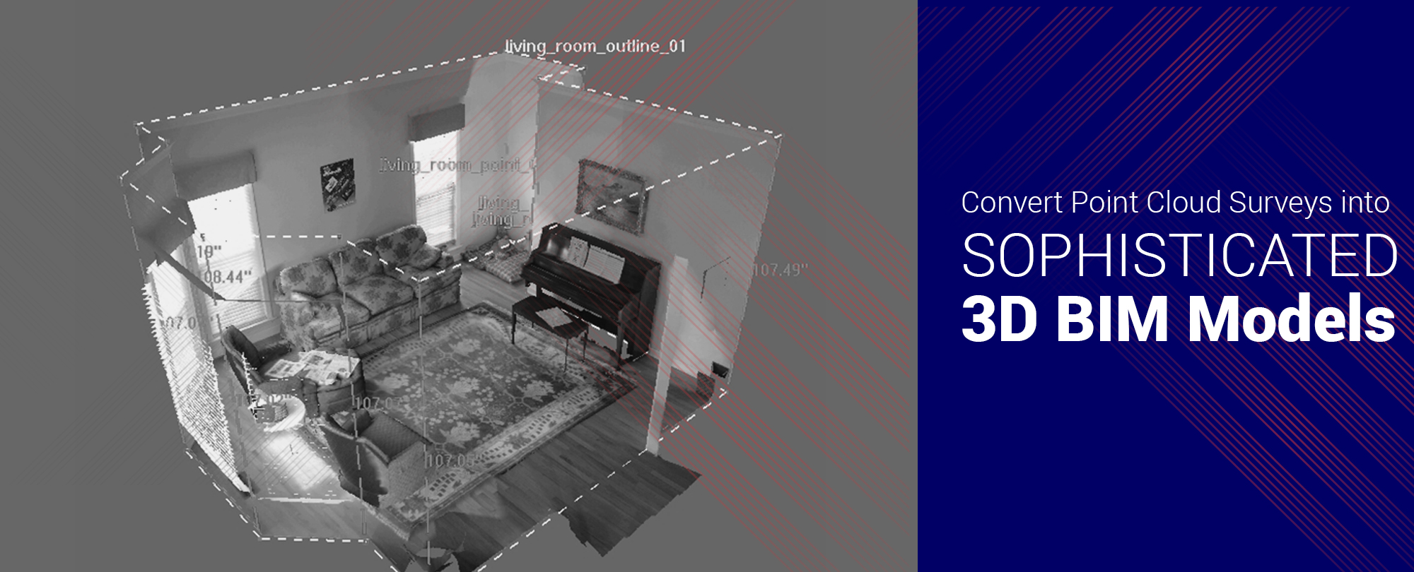
Pre-construction or renovation requires accurate planning and virtual intelligence to convert models into reality. In the early inception phase, 3D laser scanning services prove to be intuitive tools to author object models while referencing the point cloud. A point cloud is an integration of range based scanning and photogrammetry, and it serves as an initial point of building a 3D model. So, basically a point cloud system is a huge collection of points in 3D space, thus it serves as a very precise measurement to create content from within the point cloud. Thousands of laser beams are fired per second, resulting in the formation of point cloud data . The resulting point cloud can bring about Billions of data that can be used for analysis and modeling in BIM.
From Point Clouds to BIM – Understanding the transition & how it can help
A typical scan to BIM to process with Point Cloud involves three phases namely –
• Modeling the geometry of components
• Assigning object categories and material properties to components
• Establishing comprehensive component relationships
Terrestrial laser scanners are used as optical instruments that allow the creation of geometric representations in real-time. This is achieved by a collection of 3D points that form the point cloud environment. A TLS or Terrestrial Laser Scanning instrument is used to perform multiple tasks in a very short duration. Snapshots can be recorded by the TLS in a very short time as the sensor allows multiple conditions of the surveyed object to be captured. This technique is used in the fields of cultural heritage capturing, it provides a means to store documentation, monitor present conditions of important buildings, and support the restoration process. All the 3D models store numeric and qualitative information for further reference. Airborne Laser Scanning or ALS is also be used as an automation tool to reconstruct building shapes, that can be integrated with airborne and terrestrial images. In the present scenario laser scanning surveys are gaining more traction to generate 3D structural models, as advanced systems can process large datasets. 3D laser scanning services aim at precise building reconstruction using its geometry. A finite element model is applied to a 3D cloud point model, as it generates a cross-section of the building, that can be applied to structural analysis as well. The interoperability of BIM with Point Cloud Laser Scanning provides sharp BIM models. Point cloud data can be imported to the following software’s like Revit to ensure all the models are built smartly, and serve an optimized building purpose.
Models and their choice of selection
Point Cloud to BIM can be used to create various models depending on the requirement of the infrastructure or space. Models can be classified through
• Primitives
• Mesh Based Models
• Hybrid Models
For a primitive approach all the points in the point cloud are segregated to various geometric shapes like cylinders, cones, spheres, planes, and various other 3D shapes. A mesh based model is deployed when infrastructure or a surface under consideration requires a very high requirement of details, as it requires greater computational power, the final build would also require large volumes of storage space. As the name suggests, hybrid models integrate primitives and mesh based models for various detailing requirements.
Benefits that come along with 3D Laser Scanning Services to BIM
• High level of 3D modeling accuracy with data intelligence and reliability
• Pre-planning platform for design work
• Improves communication and collaboration with 3D visualization for decision making and renovation
• Purge all RFI paperwork, construction delays, increase accuracy, and fuel outright completion
• Save time and money with digital construction techniques rather than onsite visits
The Judgment
The deployment of Point Cloud and 3D Laser Scanning Technology adds a new realm of high value possibilities in real-time to BIM workflows. Precise data captures and detailed information about various spatial elements increases the accuracy of project progress and completion. The onset of remarkable hardware and software integration makes it possible for contractors and project teams to put in their valuable time into a fully unified BIM workflow process.
Read Further on – Latest BIM Technologies